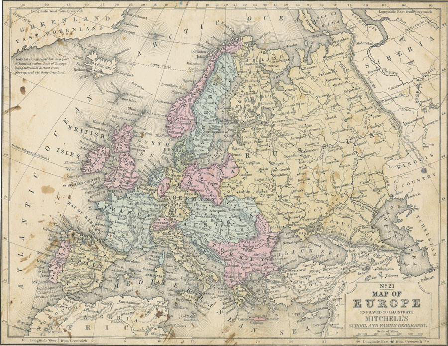
Description: A map of Europe in 1858 showing country borders of the time, including Prussia, Bavaria, Saxony and European Turkey, and regions including Poland in Russia, Galicia, Hungary, Croatia, Dalmatia, Slavonia, and Transylvania in Austria, and Moldavia, Servia, and Wallachia in Turkey. The only railways shown on this map run from Moscow and Dunaburg (Daugavpils, Latvia) to St. Petersburg. Map notation indicates "Iceland is now regarded as a part of America rather than Europe, being 600 miles distant from Norway, and 140 from Greenland."
Place Names: A Complete Map of Europe, France, �Germany, �Greece, �Italy, �Portugal, �Spain, �Sweden, �England, Scotland, Wales, Norway, Switzerland, Finland, Lapland, Turkey, Austria, Belgium, Holland, Iceland, Anatolia
ISO Topic Categories: boundaries,
inlandWaters,
location,
oceans
Keywords: Map of Europe, physical, �political, physical features, country borders, boundaries,
inlandWaters,
location,
oceans, Unknown, 1858
Source: , Mitchell's School Atlas (Philadelphia, Pennsylvania: E. H. Butler & Co., 1863)
Map Credit: Courtesy the private collection of Roy Winkelman |
|