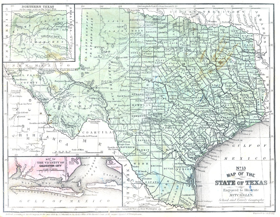
Description: A map from 1853 of Texas showing the capital at Austin, county lines at the time, principal cities and towns, railroads, mountains, rivers, and coastal features. The map shows the tribal lands in the western part of the state. Longitudes from Greenwich given at the top of the map, and from Washington at the bottom.
Place Names: Texas, Austin, �San Antonio, �Houston, �Galveston, �Corpus Christi, �Waco, �Dalla
ISO Topic Categories: boundaries,
inlandWaters,
location,
oceans,
transportation
Keywords: The State of Texas, political, �transportation, �physical, physical features, country borders,
major political subdivisions,
county borders, railroads, boundaries,
inlandWaters,
location,
oceans,
transportation, Unknown, 1858
Source: , Mitchell's School Atlas (Philadelphia, PA : E. H. Butler & Co., 1863)
Map Credit: Courtesy the private collection of Roy Winkelman |
|