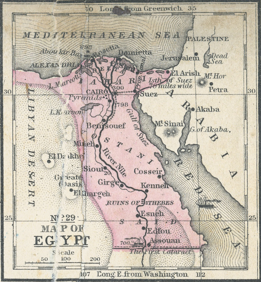
Description: Map of Egypt in 1858 from the Nile Delta south to the First Cataract, showing Cities, trade centers, oases, ports, railways, and the site of the proposed Suez Canal. Portions of the Libyan Desert, the Mediterranean Sea, the Red Sea and Arabia are also shown.
Place Names: Egypt, Cairo, �Alexandria, �Suez, �Mineh, Esneh, Assouan, Edfou, Girge, Rosetta, Damietta, El Arish, Benisouef, Akaba, Mount Sinai, Mt. Sina
ISO Topic Categories: boundaries,
inlandWaters,
location,
oceans
Keywords: Map of Egypt, political, �physical, �transportation, physical features, country borders, railroads,
water routes, boundaries,
inlandWaters,
location,
oceans, Unknown, 1858
Source: , Mitchell's School Atlas (Philadelphia, Pennsylvania: E. H. Butler & Co., 1863)
Map Credit: Courtesy the private collection of Roy Winkelman |
|