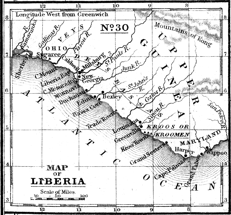
Description: Map of Liberia. The Republic of Liberia extends along the west coast of Africa from the Gallinas river, 420 miles S.E. to the San Pedro, with an average breadth inland of 40 miles, comprising an area of 16,800 square miles. It includes Liberia Proper; and Maryland, and Ohio, in Liberia. The immigrant population is bout 6000 and the native 140,000, the latter consists of various tribes of which the Veys or Feys, Deys, Bassas, Fishmen, and Kroomen, are the chief.—Mitchell's School Atlas, 1863
Place Names: Liberia, Buchanan, �Greenville, �Monrovia, Bedin, Bassa Cove, Trade Town, Louisiana, Greenville, Kroo Town, Grand Sesters, Cape Palmas, Grand Taboo, Wappo
ISO Topic Categories: boundaries,
inlandWaters,
location,
oceans
Keywords: Map of Liberia, physical, �political, �transportation, physical features, country borders,
major political subdivisions, railroads, boundaries,
inlandWaters,
location,
oceans, Unknown, 1858
Source: , Mitchell's School Atlas (Philadelphia, Pennsylvania: E. H. Butler & Co., 1863)
Map Credit: Courtesy the private collection of Roy Winkelman |
|