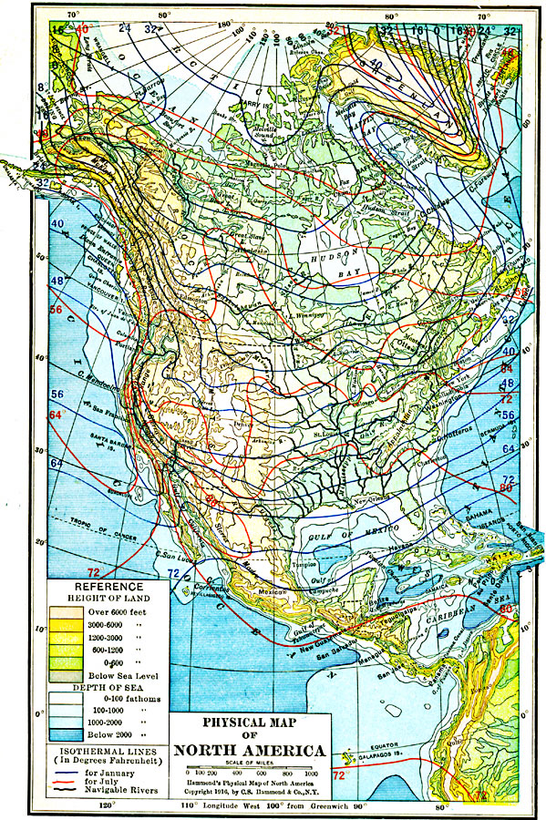
Description: A map from 1916 of North America, Central America, Greenland, and the Caribbean to Puerto Rico showing land elevations, water depths, and isothermal lines of mean temperatures for January and July. The map uses color–contouring to show land elevations from below sea level to above 6000 feet, and water depths from sea level to below 2000 fathoms. The isotherms are given in mean degrees Fahrenheit, and illustrate the effects of marine waters and latitude on temperatures. The map also shows navigable rivers.
Place Names: A Complete Map of North America, Bahamas, �Canada, �Cuba, �Mexico, �United States, �Greenland, Central Americ
ISO Topic Categories: boundaries,
climatologyMeteorologyAtmosphere,
elevation,
inlandWaters,
location,
oceans,
transportation
Keywords: North America, physical, �political, �transportation, �meteorological, �hydrological, �isothermal lines, kClimate, physical features,
topographical, country borders, water routes, temperature, water depths, boundaries,
climatologyMeteorologyAtmosphere,
elevation,
inlandWaters,
location,
oceans,
transportation, Polyconic, 1916
Source: , Hammond's Business Atlas of Economic Geography (New York, NY: C.S. Hammond and Co., 1919) 1
Map Credit: Courtesy the private collection of Roy Winkelman |
|