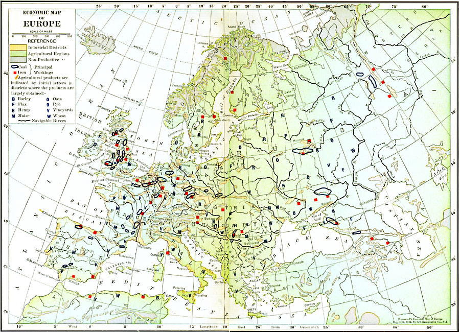
Description: An economic map of Europe in 1916 showing industrial districts, agricultural regions, and non–productive regions, principle coal and iron workings, navigable rivers, and agricultural products in primary districts where they are obtained indicated by their initial letter, for example B for barley, F for flax, W for wheat, et cetera.
Place Names: A Complete Map of Europe, Spain, �Portugal, �France, �Germany, �Greece, �Italy, �Sweden, �United Kingdom, �Norway, Bulgaria, Austria Hungary, Russia, Denmark, �Romani
ISO Topic Categories: boundaries,
inlandWaters,
location,
oceans,
economy,
transportation
Keywords: Economic Map of Europe, physical, �political, �statistical, �transportation, kEconomic, physical features, country borders, industry,
agriculture, water routes, boundaries,
inlandWaters,
location,
oceans,
economy,
transportation, Polyconic, 1916
Source: , Hammond's Business Atlas of Economic Geography (New York, New York: C.S. Hammond and Co., 1919) 10-11
Map Credit: Courtesy the private collection of Roy Winkelman |
|