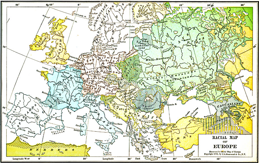
Description: A map of Europe showing the distribution of ethnic groups.
Place Names: A Complete Map of Europe, Spain, �Portugal, �France, �Germany, �Greece, �Italy, �Sweden, �United Kingdom, �Norway, Bulgaria, Austria Hungary, Russia, Denmark, �Romania, �Rumani
ISO Topic Categories: boundaries,
inlandWaters,
location,
oceans,
society
Keywords: Racial Map of Europe, physical, �political, �statistical, �ruthenians, rumanians, white-russians, catalans, erse, skandinavians, bungarians, magyars, kBiodiversity, physical features, country borders, ethnological, boundaries,
inlandWaters,
location,
oceans,
society, Polyconic, 1916
Source: , Hammond's Business Atlas of Economic Geography (New York, New York: C.S. Hammond and Co., 1919) 16
Map Credit: Courtesy the private collection of Roy Winkelman |
|