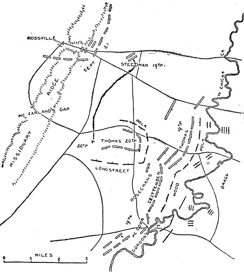
Description: A map of the region near the Chickamauga River in Georgia, site of the Battle of Chickamauga (September 19–20, 1863). The map shows the Missionary Ridge overlooking the Chickamauga River, the positions of the Union and Confederate armies on the two days of the battle, and the retreat of the Union Army to Horseshoe Ridge.
Place Names: Georgia, Missionary Ridge, Mcfarland's Gap, Rossville, Chickamauga Rive
ISO Topic Categories: transportation,
location,
inlandWaters
Keywords: Chickamauga, physical, �political, �transportation, �historical, �american civil war, steedman, thomas, longstreet, rosecrans, mccook, gordon, hood, bragg, polk, kBattle, physical features, roads, Civil War, transportation,
location,
inlandWaters, Unknown, September 1863
Source: Theodore Ayrault Dodge, A Bird's-Eye View of our Civil War (Boston, MA: Houghton, Mifflin and Company, 1897) 180
Map Credit: Courtesy the private collection of Roy Winkelman |
|