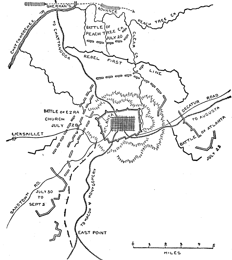
Description: A map of Atlanta and vicinity during the Atlanta Campaign of the American Civil War (1864). The map shows the fortifications around Atlanta, the positions of the Union and Confederate armies, and the sites of the Battle of Peach Tree Creek (July 20), the Battle of Atlanta or the Battle of Decatur (July 23), and the Battle of Ezra Church (July 28).
Place Names: Georgia, Atlanta, �Lickskillet, Sandtown Road, East Point, Decatur Road, Clear Creek, Peach Tree Creek, Chattahoochee Rive
ISO Topic Categories: inlandWaters,
location,
transportation
Keywords: Operations about Atlanta, physical, �political, �historical, �transportation, �american civil war, battle of ezra church, battle of atlanta, rebel first line, battle of peach tree creek, sherman's advance, kBattle, physical features, roads,
railroads, Civil War, inlandWaters,
location,
transportation, Unknown, 1864
Source: Theodore Ayrault Dodge, A Bird's-Eye View of our Civil War (Boston, MA: Houghton, Mifflin and Company, 1897) 257
Map Credit: Courtesy the private collection of Roy Winkelman |
|