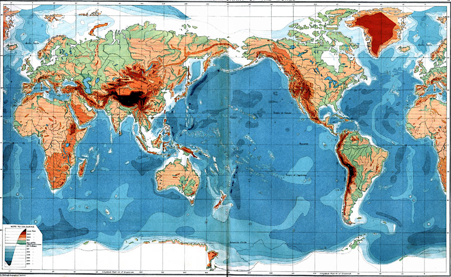
Description: A map of the Earth from 1915, showing land elevations in feet (orographic) and sea depths in fathoms (bathyographic). The map is color–contoured to show elevations from below sea level to above 12,000 feet, and depths from sea level to below 4,000 fathoms.
Place Names: A Complete Map of Globes and Multi-continent, Africa, �Antarctica, �Asia, �Australia, �Europe, �North America, �South Americ
ISO Topic Categories: oceans,
location,
elevation,
inlandWaters
Keywords: Bathy-Orographical Chart of the World, physical, �Bathy-orographical, �topographical, �hydrological, �water, physical features,
topographical, water depths, oceans,
location,
elevation,
inlandWaters, Unknown, 1915
Source: J. G. Bartholomew, A School Economic Atlas (London, England: Oxford University Press, 1915) 2-3
Map Credit: Courtesy the private collection of Roy Winkelman |
|