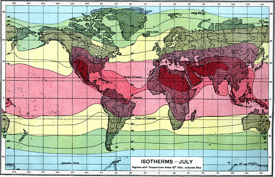
Description: An isothermal chart of the world from 1915 showing typical isotherm patterns for the month of July. This map is color–coded to show progressive temperature regions, ranging from below 32° Fahrenheit (blue) to above 90° Fahrenheit (red). Temperatures are shown on the isotherms, given in degrees Fahrenheit.
Place Names: A Complete Map of Globes and Multi-continent, Africa, �Antarctica, �Asia, �Australia, �Europe, �North America, �South Americ
ISO Topic Categories: oceans,
climatologyMeteorologyAtmosphere,
inlandWaters
Keywords: Isotherms - July, physical, �meteorological, �isotherms, �climate lines, �temperature zones, kClimate, physical features, climate,
temperature, oceans,
climatologyMeteorologyAtmosphere,
inlandWaters, Unknown, 1915
Source: J. G. Bartholomew, A School Economic Atlas (London, England: Oxford University Press, 1915) 4
Map Credit: Courtesy the private collection of Roy Winkelman |
|