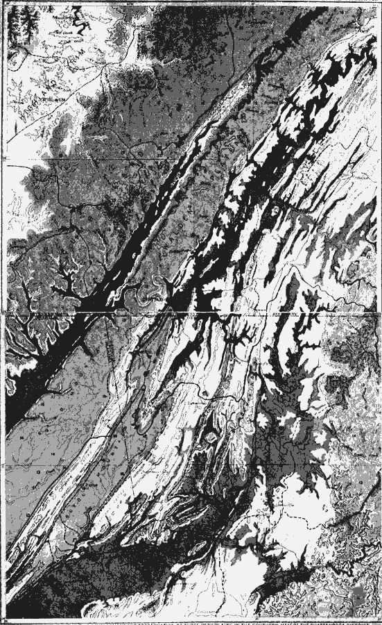
Description: An orographical map from 1911 of the Chattanooga District of the Appalachian mountain system. The map shows the relative development and preservation of three peneplains in the southern half of the Chattanooga district. Darkest areas indicate base–leveled areas of the late Tertiary or Coosa peneplain; lightest shade areas indicate early Tertiary or Highland Rim peneplain; and the intermediate shade indicates remnants of the Cretaceous or Cumberland peneplain. Residuals above the Cumberland peneplain are shown in slightly darker shade.
Place Names: Eastern States, Appalachian Mountains, �Tennessee, �Kentucky,
ISO Topic Categories: boundaries,
inlandWaters,
location,
geoscientificInformation
Keywords: Development of Three Peneplains in the Chattanooga District, physical, kGeology, kOrographic, physical features,
geological, boundaries,
inlandWaters,
location,
geoscientificInformation, Unknown, 1911
Source: Isaiah Bowman, Ph. D, Forest Physiography (New York, NY: John Wiley and Sons, 1911) 595
Map Credit: Courtesy the private collection of Roy Winkelman |
|