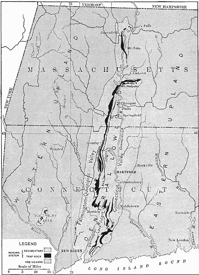
Description: The relation of the Connecticut Valley lowland to the bordering uplands, the extent of the lowland, principal relief features, and drainage systems.
Place Names: New England States, New Haven, �Hartford, �Massachusetts, �Connecticut, �New Yor
ISO Topic Categories: geoscientificInformation,
boundaries,
inlandWaters,
location,
oceans
Keywords: Connecticut Valley Lowlands, physical, �political, �hydrological, kGeology, physical features,
geological, major political subdivisions, drainage basins, geoscientificInformation,
boundaries,
inlandWaters,
location,
oceans, Unknown, 1911
Source: Isaiah Bowman, Ph. D, Forest Physiography (New York, NY: John Wiley and Sons, 1911) 654
Map Credit: Courtesy the private collection of Roy Winkelman |
|