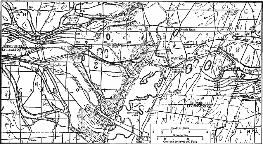
Description: A map from 1911 showing the abandoned channels and deltas of a part of the ice–border drainage between Leroy and Fishers, New York after the last glacial period. The map is keyed to show the glacial stream channels, deltas, and the wave works of the glacial era lakes Warren and Dana.
Place Names: New York,
ISO Topic Categories: boundaries,
location,
inlandWaters
Keywords: Ice-border Drainage, political, �transportation, �physical, kGlacial, physical features, county borders, railroads, boundaries,
location,
inlandWaters, Unknown, 1911
Source: Isaiah Bowman, Ph. D, Forest Physiography (New York, NY: John Wiley and Sons, 1911) 714
Map Credit: Courtesy the private collection of Roy Winkelman |
|