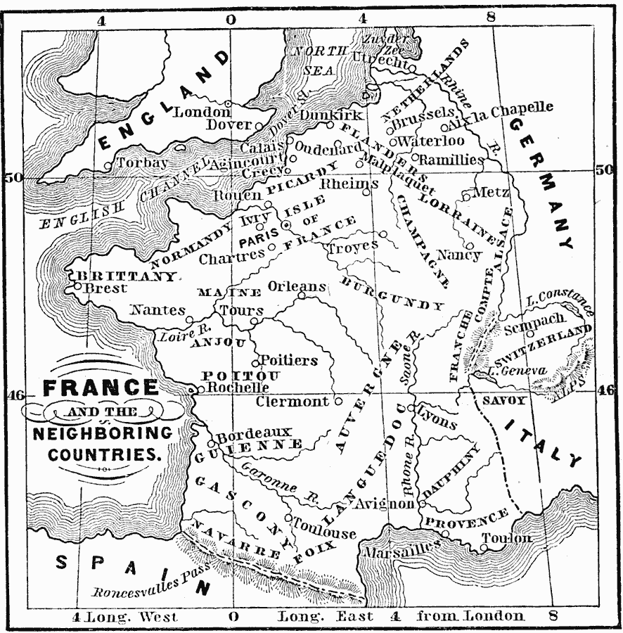
Description: A map of France and the neighboring countries from the time of the Norman Conquest (1066) to the beginnings of the Angevin Empire under Henry Pantagenet (1154). This map shows the French territories of Netherlands, Flanders, Lorraine, Picardy, Isle of France, Normandy, Champagne, Brittany, Maine, Burgundy, Anjou, Alsace, Franche–Comte, Poitou, Auvergne, Guienne, Gascony, Navarre, Foix, Languedoc, Dauphiny, and Provence.
Place Names: France, Tours, �Orleans, �Nancy, �Avignon, �Paris, �Brittany, �Brussels, �Waterloo, �Marsaille
ISO Topic Categories: boundaries,
inlandWaters,
location,
oceans
Keywords: France and Neighboring Countries, physical, �political, physical features, country borders, boundaries,
inlandWaters,
location,
oceans, Unknown, 1066–1154
Source: John J. Anderson, Ph.D., A School History of England (New York, NY: Effingham Maynard and Co., 1889) 73
Map Credit: Courtesy the private collection of Roy Winkelman |
|