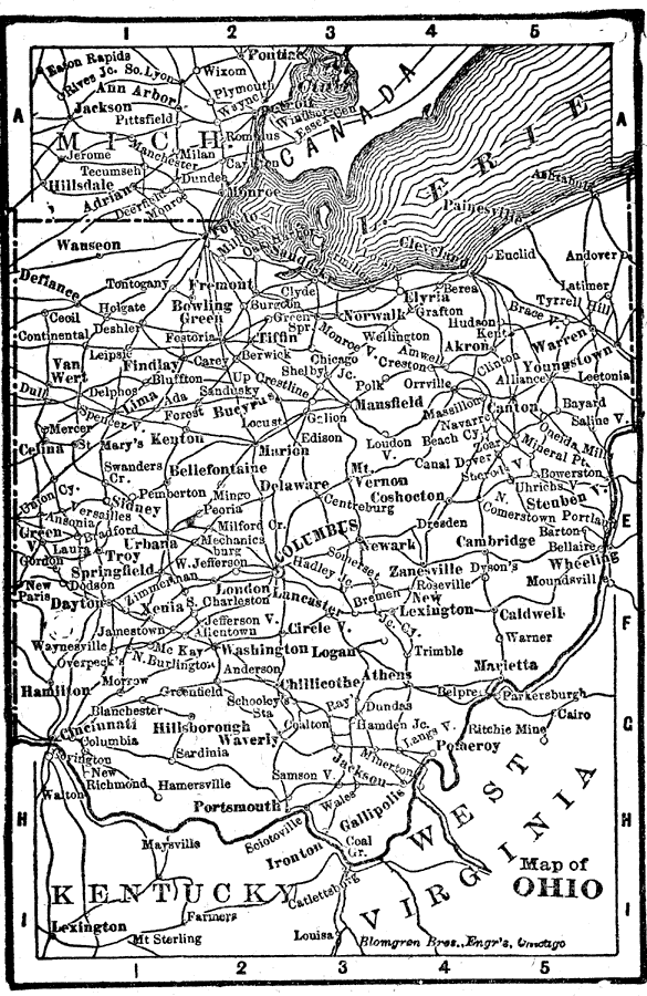
Description: A map from 1899 of Ohio showing the capital of Columbus, principal cities and towns, railroads, and rivers. "Ohio, name of Indian origin, signifying ‘Beautiful River.’ The ‘Buckeye State.’ Explored by La Salle 1679. Ohio Territory organized May 7, 1800. Admitted as a State April 30, 1802. First permanent settlement at Marietta, 1788." — Edison.
Place Names: Ohio, Columbus, �Cleveland, �Cincinatti, �Toledo, �Dayton, �Hamilton, �Sandusky, �Springfield, �Akron, �Zanesvill
ISO Topic Categories: boundaries,
inlandWaters,
location
Keywords: Ohio, physical, physical features, boundaries,
inlandWaters,
location, Unknown, 1898
Source: Thomas F. Edison, Edison's Handy Encyclopaedia of General Information and Universal Atlas (Chicago, IL: Laird and Lee, 1898) 478
Map Credit: Courtesy the private collection of Roy Winkelman |
|