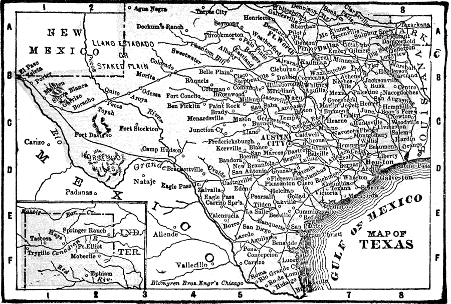
Description: A map from 1898 of Texas showing the capital at Austin City, principal cities and towns, railroads, rivers, and coastal features. "Lone Star State. Origin of name not definitely known; supposed by some to have been name of Indian tribe. Settled first by French under La Salle 1685; was a part of Old Mexico. Independence declared December 20, 1835. Houston inaugurated as President October, 1836. Independence of the Republic recognized by United States March, 1837, by European powers 1839 and '40. Proposition for union with United States 1845, and admitted as a State December 29. State paid 10,000,000 dollars by United States for all lands outside present limits 1850. Seceded February 1861. Houston, who refused to secede, deposed. Re–entered Union 1870." — Edison, 1898.
Place Names: Texas, Austin, �Dallas, �Galveston, �Houston, �Brownsville, �Corpus Christi, �Waco, �El Paso, �San Antoni
ISO Topic Categories: boundaries,
inlandWaters,
location
Keywords: Texas, physical, physical features, boundaries,
inlandWaters,
location, Unknown, 1898
Source: Thomas F. Edison, Edison's Handy Encyclopaedia of General Information and Universal Atlas (Chicago, IL: Laird and Lee, 1898) 494
Map Credit: Courtesy the private collection of Roy Winkelman |
|