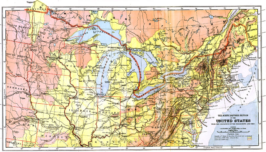
Description: The Northeastern section of United States from the confluence of the Mississippi and Ohio Rivers, showing state boundaries, major cities, railroad lines, canals and navigational rivers. Physical features such as mountain ranges with elevation measured in feet, major rivers and watersheds, and continental shelf boundaries are also shown. An interesting feature is the latitude for prominent cities of the world are shown along the east/west border of the map. The capitals of States and Canadian Provinces are underlined.
Place Names: Eastern States, Boston, �Chicago, �New York, �Washington D.C., �Omaha, �Louisville, �Richmond, �Middle Atlantic States, �Mid-Atlantic States, �New England, �New York Stat
ISO Topic Categories: boundaries,
elevation,
inlandWaters,
oceans
Keywords: The North Eastern Section of the United States, physical, �political, �transportation, �Conic Projection, physical features,
topographical, country borders,
major political subdivisions, railroads,
water routes, boundaries,
elevation,
inlandWaters,
oceans, Other, 1904
Source: Geo. G. Chisholm and C.H. Leete, eds., Longmans' New School Atlas (New York, NY: Longmans, Green, and Co., 1904) 13
Map Credit: Courtesy the private collection of Roy Winkelman |
|