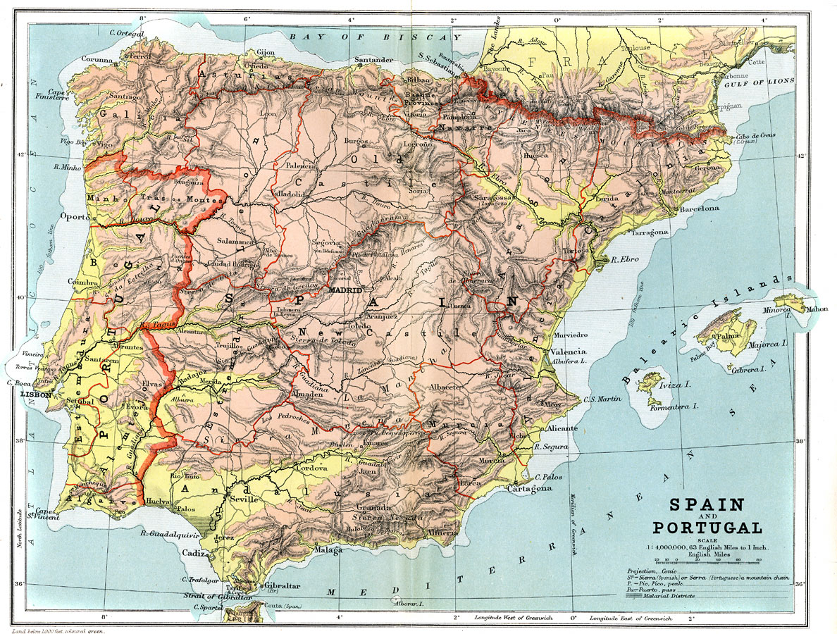
Description: A geo–political map from 1904 of Spain and Portugal (and Andorra) showing country and autonomous community borders, capitals and major cities, railroad lines, canals and navigable rivers. Physical features include mountain ranges with elevation measured in feet, major rivers and watersheds, and the 100–fathom line in the offshore waters. Generalized elevations shown as land below 1,000 feet colored light green, and land above 1,000 feet in elevation colored brown. Malarial districts are shown north of Cadiz, south of Valencia, on the Ebro River delta, and along the Gulf of Lions.
Place Names: Iberian Peninsula, Portugal, �Spain, �Andorra, �Balearic Islands, �Palma, �Madrid, �Lisbon, �River Tagus, �Madrid, �Strait of Gibraltar, �Valencia, �Barcelona, �Bilbao, �Pyrenees Mountains,
ISO Topic Categories: boundaries,
elevation,
inlandWaters,
oceans,
transportation
Keywords: Spain and Portugal, physical, �political, �transportation, �Conic Projection, physical features,
topographical, country borders,
local jurisdictions, railroads,
water routes, boundaries,
elevation,
inlandWaters,
oceans,
transportation, Other, 1904
Source: Geo. G. Chisholm and C.H. Leete, eds., Longmans' New School Atlas (New York, NY: Longmans, Green, and Co., 1904) 29
Map Credit: Courtesy the private collection of Roy Winkelman |
|