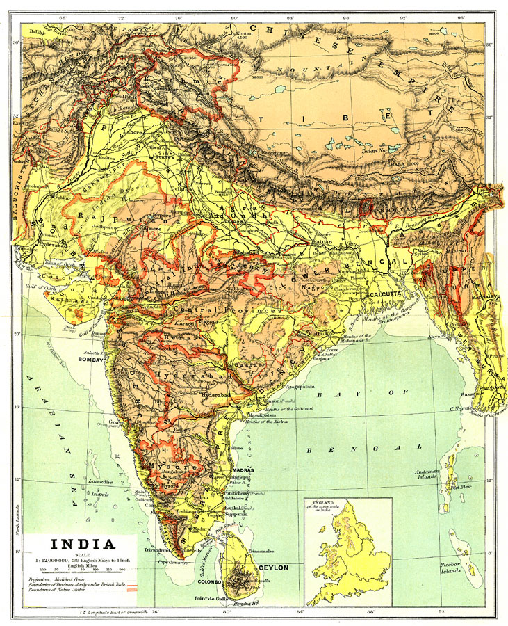
Description: India, showing country, province and native state borders current to 1904, major cities, railroad lines, and navigable rivers. Physical features include mountain ranges with elevation measured in feet, major rivers and watersheds, and the 100-fathom line in the offshore waters. Generalized elevations shown as land below 1,000 feet colored light green, and land above 1,000 feet in elevation colored brown. An inset of England is included for showing comparative scaled area.
Place Names: India , Mumbai, �New Delhi, �Nagpur, �Kolkata, �Cochin, �Sikkim, �Nepal, �Kashmir, Delhi, �Bombay, �Calcutta, �Madras, �Ceylon, �Sri Lanka, �Kandy, �River Ganges, �River Indus, �Bhutan, �Goa, �Mount Everes
ISO Topic Categories: boundaries,
elevation,
inlandWaters,
oceans,
transportation
Keywords: India, physical, �political, �transportation, �Modified Conic Projection, physical features,
topographical, country borders,
major political subdivisions,
local jurisdictions, railroads,
water routes, boundaries,
elevation,
inlandWaters,
oceans,
transportation, Other, 1904
Source: Geo. G. Chisholm and C.H. Leete, eds., Longmans' New School Atlas (New York, NY: Longmans, Green, and Co., 1904) 35
Map Credit: Courtesy the private collection of Roy Winkelman |
|