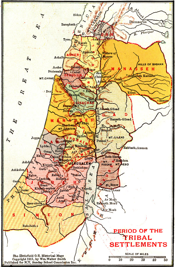
Description: A map of the Palestine region showing the territorial boundaries of the twelve tribes of Israel (1200–539 BC).
Place Names: A Regional Map of Asia, Great Sea, �Mediterranean Sea, �Phoenicia, �Asher, �Dan, �Manasseh, �Gad, �Naphtali, �Zebulun, �Reuben, �Benjamin, ��Issachar, �Judah, �Simeon, �Ephraim, �Salt Sea, �Dead Sea, �Philistia, �River Jordan,
ISO Topic Categories: boundaries
Keywords: Palestine during the Period of the Tribal Settlements, physical, �political, physical features, major political subdivisions, boundaries, Unknown, 1200–539 BC
Source: William Walter Smith, The Students' Illustrated Historical Geography of the Holy Land (Philadelphia, PA: The Sunday School Times Company, 1911) 65
Map Credit: Courtesy the private collection of Roy Winkelman |
|