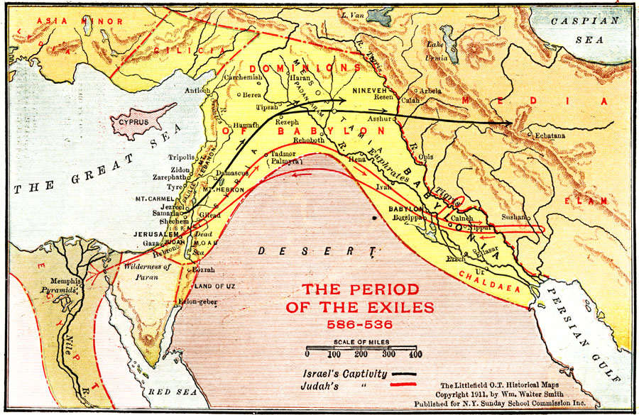
Description: A map of Egypt, Wilderness of Paran, Dominions of Babylon, and Media during the period of the exiles (586–536 BC) showing the principal cities of the region and the routes of Israel's captivity and Judah's route between Egypt and Media.
Place Names: A Regional Map of Asia, Great Sea, �Mediterranean Sea, �Asia Minor, �Lydia, �Cilicia, �Cyprus, �Dominions of Babylon, �Media, �Elam, �Jerusalem, �Tyre, �Judah, �Gaza, �Hebron, �Damascus, �Syria, �Nineveh, �Babylonia, �River Tigris, �Mesopotamia, �River Euphrates,�Galilee, �Is
ISO Topic Categories: boundaries,
inlandWaters,
location
Keywords: Period of the Exiles, physical, �political, physical features, country borders, boundaries,
inlandWaters,
location, Unknown, 586–536 BC
Source: William Walter Smith, The Students' Illustrated Historical Geography of the Holy Land (Philadelphia, PA: The Sunday School Times Company, 1911) 65
Map Credit: Courtesy the private collection of Roy Winkelman |
|