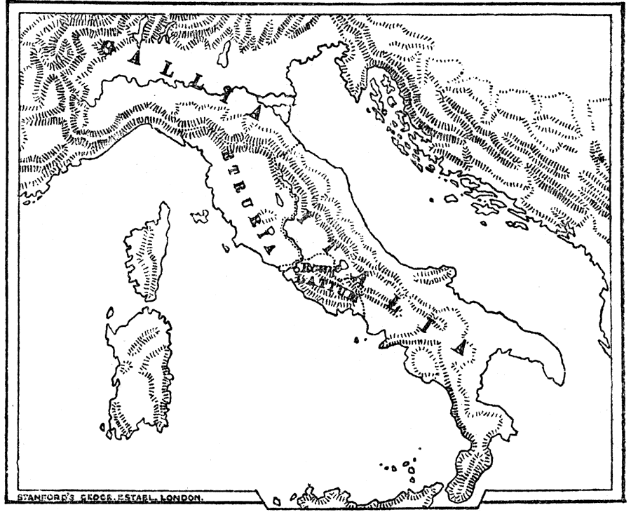
Description: "Italy at present is bounded on the north by the Alps. But in the year 753 before the birth of Christ, when Rome was founded, the great plain between the Alps and the Apennines, which we now call Lombardy, belonged to the Gauls, and was called Gallia. Also, on the west coast between the Apennines and the River Tiber, lived the Etruscans, who were the greatest people in the peninsula at that time. The land which they lived in is still called Tuscany after them. South of the Gauls and Etruscans came the Italians, amongst whom the Latins were the principle race. The Latins lived in the plain south of the Tiber, and were an agricultural people...It would seem that about the year 753 B.C. these Latins founded a colony on the Tiber, to guard the river against the Etruscans, of whom they were afraid. This colony was called Rome, and as it was founded upon the great river of that part of Italy, it soon became of importance for trade as well as for keeping off the Etruscans." — Creighton, 1890
Place Names: Italy, Rome, �Gallia, �Etruria, �Latium, �Italia,
ISO Topic Categories: oceans,
society
Keywords: Italy at the time of Rome's founding, physical, �historical, kAncientRome, physical features,
topographical, oceans,
society, Unknown, 753 BC
Source: M. Creighton, History of Rome (New York, NY: D. Appleton and Company, 1890) 7
Map Credit: Courtesy the private collection of Roy Winkelman |
|