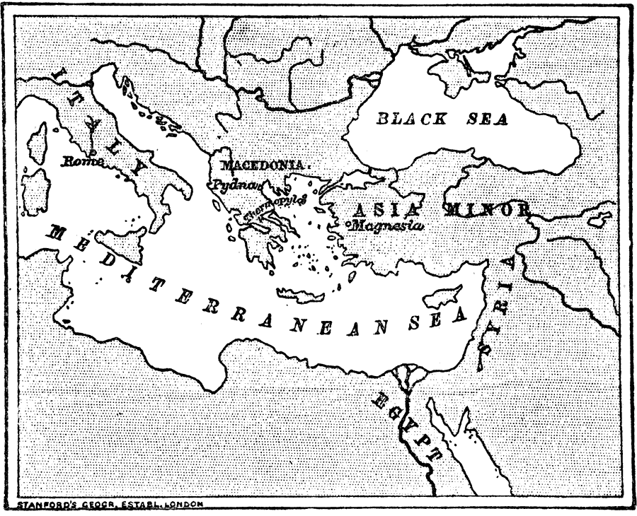
Description: The eastern Mediterranean region, including Macedonia, Asia Minor, Syria, and Egypt. "...when the Romans first had anything to do with the east, there were three great kingdoms: (1.) Macedonia, which ruled over the greater part of Greece. (2.) Syria, which ruled over Asia Minor, though there was there a number of small states. (3.) Egypt, which was very rich, and traded a great deal from its capital, Alexandria...6. Rome's position in BC 133. — Thus you see that in the year 133 Rome, besides ruling Italy, was ruler also of Macedonia, Greece, Asia, Spain and Africa, in fact all the countries round the Mediterranean Sea, which thus became a Roman lake." — Creighton, 1890
Place Names: Regional Mediterranean, Mediterranean Sea, �Black Sea, �Asia Minor, �Macedonia, �Pydna, �Magnesia, �Syria, �Egypt, �Italy, �Rome,
ISO Topic Categories: physical, �historical, kWorldMedSea
Keywords: Rome and the Eastern Countries, physical, �historical, physical features, physical, �historical, kWorldMedSea, Unknown, 200–133 BC
Source: M. Creighton, History of Rome (New York, NY: D. Appleton and Company, 1890) 48
Map Credit: Courtesy the private collection of Roy Winkelman |
|