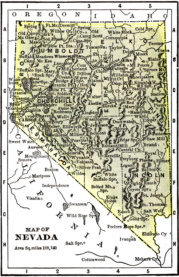
Description: A map from 1904 of Nevada showing the capital of Carson City, major cities and towns, railroads, mountains, lakes, and rivers. "Nevada (Sage Hen State) — Created a Territory in 1861, declared a state in 1864. The real growth of the State dates from the discovery of silver in 1859. Area, 110,70 square miles; population 42,000. There has been in the last few years a decrease in gold and silver mining. Car construction and repair work are the leading industries. Flour and grist mill and manufacture of butter, cheese, and condensed milk form other important industries. Ranks ninth in gold, forty–eighth in wealth, fifty–second in population. The Governor receives $4,000." — Wark 1904.
Place Names: Nevada, Aurora, �Carson City, �Reno, �Humbolt, �Elko, �Lincoln, �Esmeralda, �Churchill, �Eureka, �Nye,
ISO Topic Categories: transportation,
society
Keywords: Nevada, physical, �political, �transportation, kNativeAmerican, physical features,
topographical, major political subdivisions,
county borders, railroads, transportation,
society, Unknown, 1904
Source: Henry Wark, ed. , Wark's Modern Educator (New York, NY: Henry Wark, 1904) 878
Map Credit: Courtesy the private collection of Roy Winkelman |
|