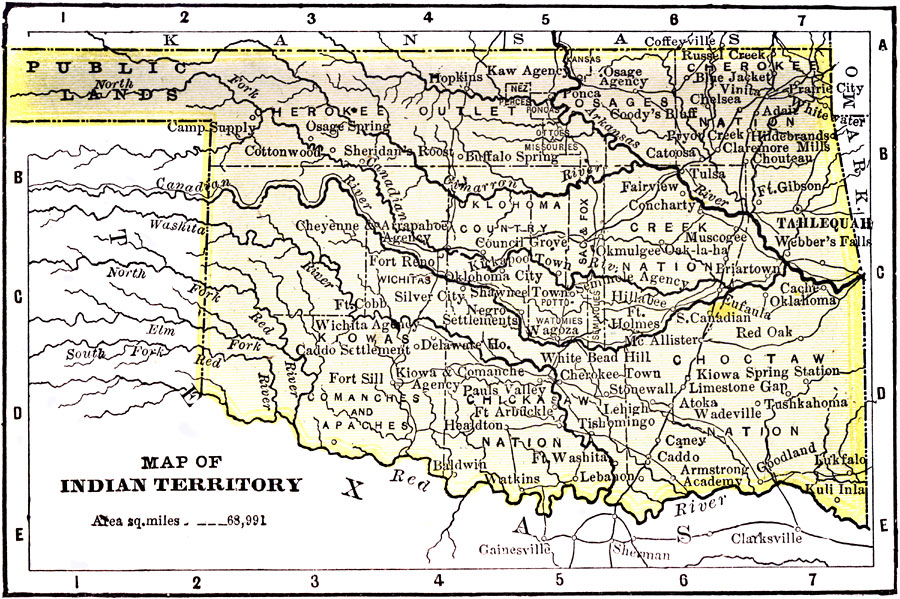
Description: A map from 1904 of the Indian Territory and Oklahoma Territory prior to statehood (November 16, 1907), showing the territorial capital of Tahlequah, reservation boundaries, railroads, and rivers. "Indian Territory had a area of 31,154 square miles, and a population of 391,960. An unorganized Territory set apart as an Indian Reservation in 1834. Five nations and seven reservations in the Territory. Agriculture is the principal occupation. Stock-raising is carried on extensively." — Wark 1904.
Place Names: Oklahoma, Oklahoma City, �Shawnee, �Choctaw, �Comanches, �Arkansas River, �Cheroke
ISO Topic Categories: transportation,
society
Keywords: Indian Territory, physical, �transportation, �political, kNativeAmerican, physical features, major political subdivisions, railroads, transportation,
society, Unknown, 1904
Source: Henry Wark, ed. , Wark's Modern Educator (New York, NY: Henry Wark, 1904) 881
Map Credit: Courtesy the private collection of Roy Winkelman |
|
