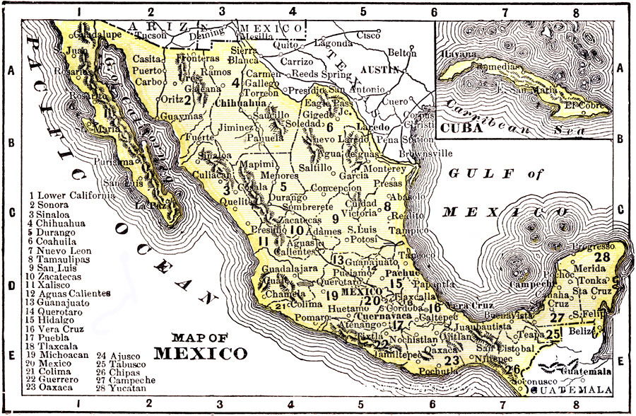
Description: A map from 1904 of Mexico showing the states, major cities and towns, railroads, mountains, and coastal features. An inset map shows the island of Cuba. "Mexico is divided into twenty-seven States with two Territories and the federal district. Has an area of 767,005 square miles, and a population of 13,545,462. Mining is the most important industry, nearly all the valuable metals being found in working quantities. Principal crop is wheat. The capital is City of Mexico with a population of 344,721." — Wark 1904.
Place Names: Mexico, Tampico, �Veracruz, �Tijuana, �Mexico City, �Merida, �Cuba, �La Paz, �Acapulco, �Cancu
ISO Topic Categories: society
Keywords: Mexico, physical, �political, physical features, country borders,
major political subdivisions, society, Unknown, 1904
Source: Henry Wark, ed. , Wark's Modern Educator (New York, NY: Henry Wark, 1904) 881
Map Credit: Courtesy the private collection of Roy Winkelman |
|