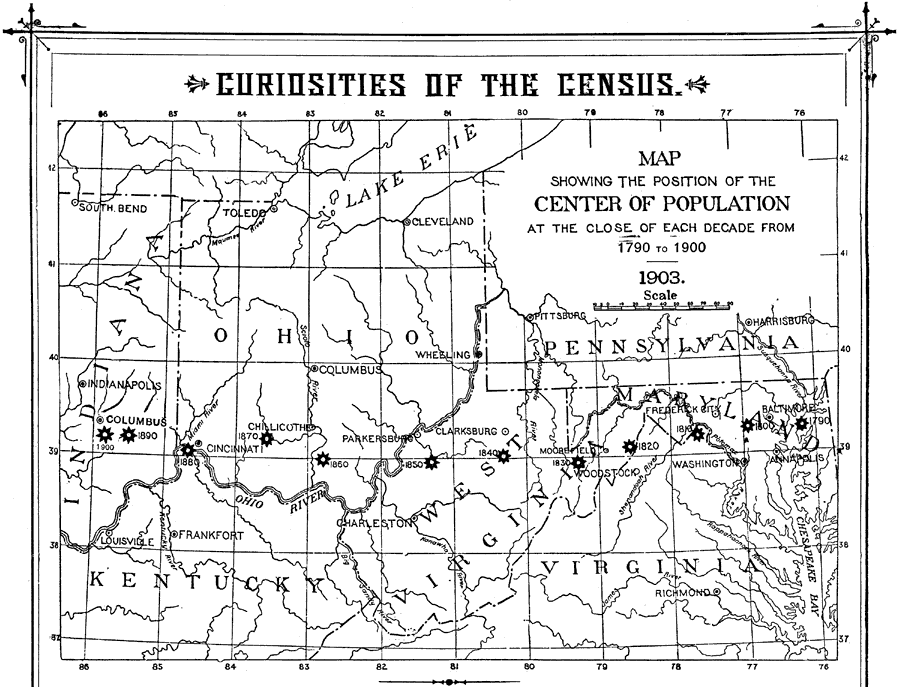
Description: A map from 1904 of the eastern United States showing the westward progression of the centers of population from 1790 to 1900. "The centre of population is defined as ‘the point at which equilibrium would be reached were the country taken as a plane surface itself, without weight, but capable of sustaining weight, and loaded with its inhabitants in number and position as they are found at the period under considerable, each individual being assumed to be of the same gravity as every other, and consequently to exert pressure on the pivotal point directly proportioned to his distance therefrom.’ In brief, it is the centre of gravity of the population of the country. It is located [1900] six miles southeast of Columbus, Indiana." — Wark, 1904.
Place Names: Demographics, Ohio, �West Virginia, �Virginia, �Kentucky, �Pennsylvania, �Indiana, �populatio
ISO Topic Categories: society,
inlandWaters
Keywords: The Center of Population in the United States, physical, �statistical, �political, kPopulation, physical features, major political subdivisions, population, society,
inlandWaters, Unknown, 1790–1900
Source: Henry Wark, ed. , Wark's Modern Educator (New York, NY: Henry Wark, 1904) 955
Map Credit: Courtesy the private collection of Roy Winkelman |
|