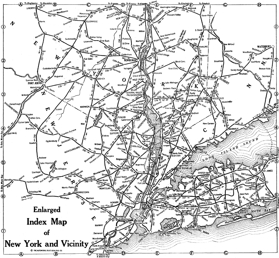
Description: New York and vicinity, including parts of Connecticut and Vermont.
Place Names: Middle Atlantic States, New York City, �Brooklyn, �Newburgh, �Poughkeepsie, �Port Jervis, �Vermont, �New York, �Connecticut, �Waterbury, �Danbury, ��New York State, �Middle Atlantic States, �New England, �Mid-Atlantic State
ISO Topic Categories: boundaries,
inlandWaters,
location,
transportation
Keywords: Enlarged Index Map of New York and Vicinity, physical, �transportation, kAutomobile, physical features, roads,
water routes, boundaries,
inlandWaters,
location,
transportation, Unknown,1920
Source: , Automobile Club of Rochester (New York, NY: The Automobile Club of Rochester, 1920) 5
Map Credit: Courtesy the private collection of Roy Winkelman |
|