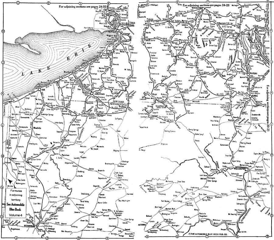
Description: New York and Pennsylvania south and east of Lake Erie, showing roads.
Place Names: Middle Atlantic States, New York, �Pennsylvania, �Buffalo, �Westfield, �Erie, �Mercer, �Pittsburgh, �Rochester, �Watkins, �Elmira, �Williamsport, �Altoona, �roads,
ISO Topic Categories: boundaries,
inlandWaters,
location,
transportation
Keywords: Lake Erie Vicinity, physical, �political, �transportation, kAutomobile, physical features, major political subdivisions, roads, boundaries,
inlandWaters,
location,
transportation, Unknown,1920
Source: , Automobile Club of Rochester (New York, NY: The Automobile Club of Rochester, 1920) 22-23
Map Credit: Courtesy the private collection of Roy Winkelman |
|