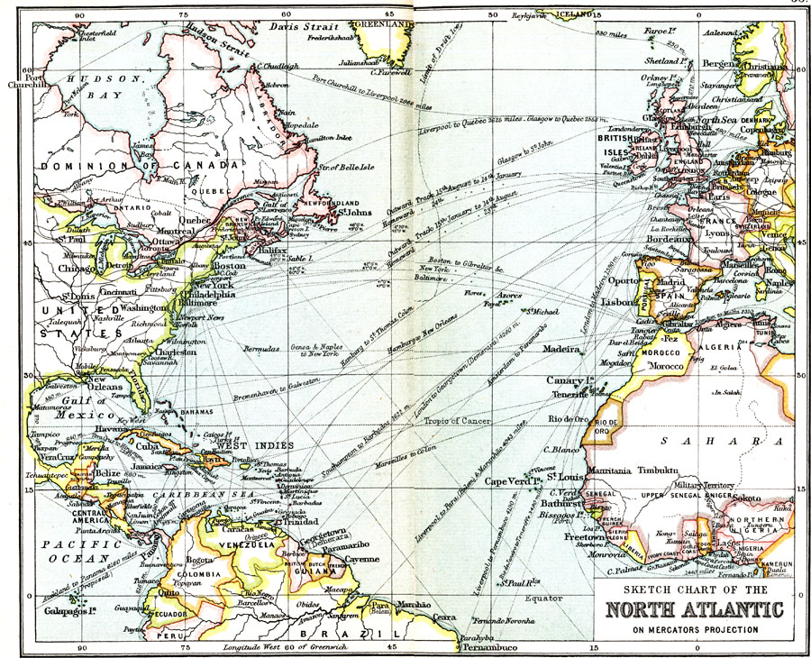
Description: This map of the North Atlantic Ocean shows the various steamship routes and the distances of each in miles.
Place Names: Regional Atlantic Ocean, North America, �South America, �Europe, �Afric
ISO Topic Categories: political, �transportation, kWorldAtlantic
Keywords: Sketch Chart of the North Atlantic, political, �transportation, country borders, water routes, political, �transportation, kWorldAtlantic, Mercator, 1911
Source: Ernest Rhys, Ed., A Literary and Historical Atlas of North & South America (New York, NY: E.P. Dutton & CO., 1911) 32
Map Credit: Courtesy the private collection of Roy Winkelman |
|