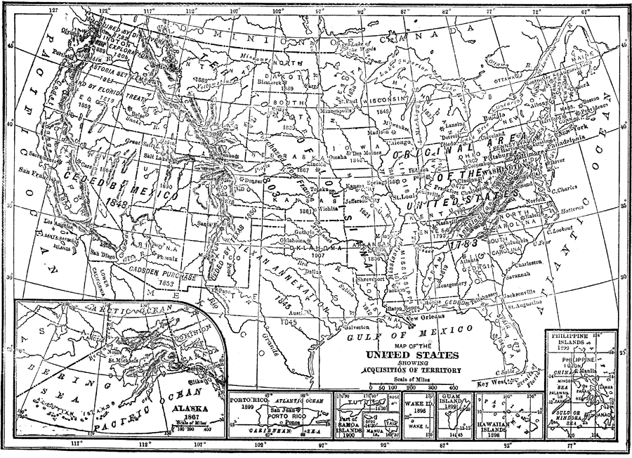
Description: A map from 1912 of the United States and its territories between 1783 and 1900 showing the nation's expansion and date of acquisition of each state or territory. The map also shows major cities, waterways, and mountain ranges. Includes insert maps detailing the territories of Alaska, Porto Rico, Samoa Islands, Manua, Wake Island, Guam Island, Hawaiian Islands, and Philippine Islands.
Place Names: Growth of Nation, Boston, �Chicago, �Los Angeles, �New Orleans, �New York, �San Diego, �Seattle, �Washington D.C., �Alaska, �Porto Rico, �Samoa Islands, �Manua, �Wake Island, �Guam Island, �Hawaiian Islands, �Philippine Island
ISO Topic Categories: boundaries,
inlandWaters,
oceans
Keywords: United States Showing Acquisition of Territory, physical, �political, physical features, country borders,
major political subdivisions, boundaries,
inlandWaters,
oceans, Unknown, 1783–1900
Source: The Manitoba Free Press, The Free Press Almanac Encyclopedia and Atlas (New York, NY: C. S. Hammond & Co., 1912) 105
Map Credit: Courtesy the private collection of Roy Winkelman |
|