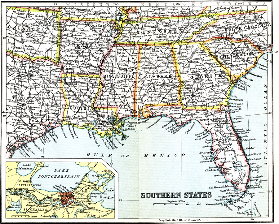
Description: The Southern States in the early twentieth century.. The inset shows the city of New Orleans, Louisiana.
Place Names: Southern States, Miami, �Houston, �New Orleans, �Florida, �Georgia, �South Carolina, �North Carolina, �Tennessee, �Alabama, �Mississippi, �Arkansas, �Louisian
ISO Topic Categories: society
Keywords: Southern States, political, �transportation, major political subdivisions, railroads, society, Unknown, 1911
Source: Ernest Rhys, Ed., A Literary and Historical Atlas of North & South America (New York, NY: E.P. Dutton & CO., 1911) 68
Map Credit: Courtesy the private collection of Roy Winkelman |
|