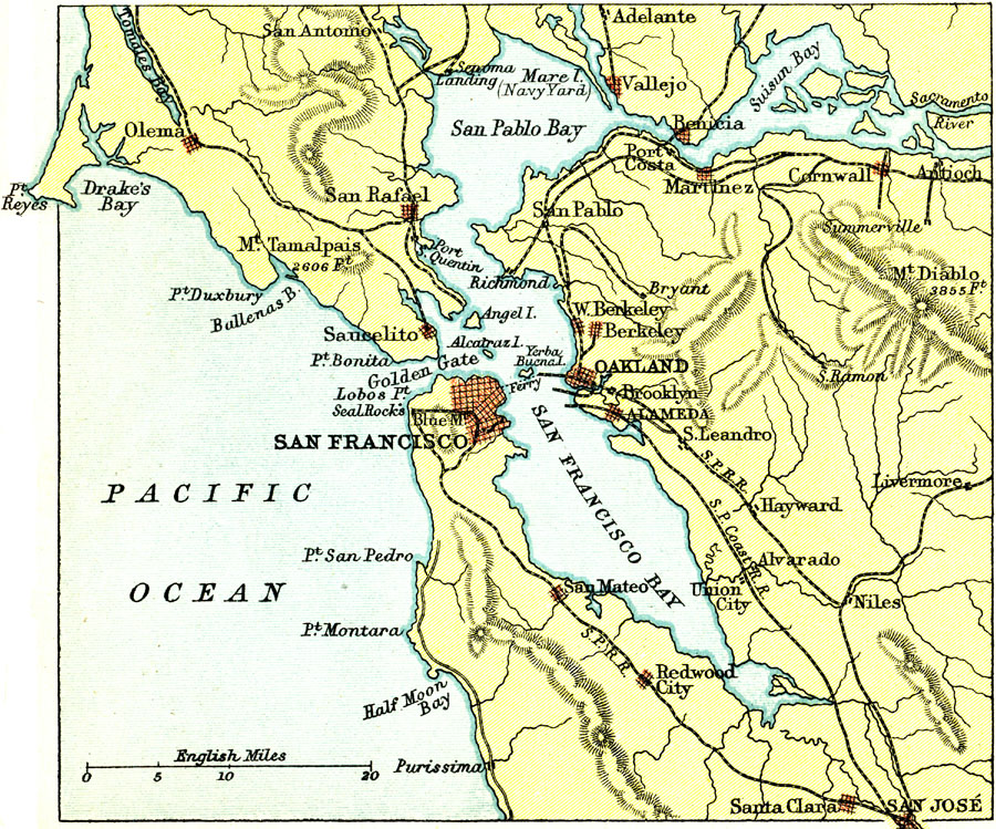
Description: A map from 1911 of the San Francisco Bay area showing the Golden Gate, San Francisco Bay, San Pablo Bay, Suisun Bay, the mouth of the Sacramento River, Alcatraz Island, Mount Diablo, the cities of San Francisco, Oakland, San Jose, and Benicia, railroads, rivers, and terrain features.
Place Names: California, San Francisco,�Oakland, �San Rafael, �Sancelito, �Alameda, �Hayward, �San Mateo, �Redwood City
ISO Topic Categories: society
Keywords: San Francisco Bay, physical, �transportation, physical features,
topographical, economic, railroads, society, Unknown, 1911
Source: Ernest Rhys, Ed., A Literary and Historical Atlas of North & South America (New York, NY: E.P. Dutton & CO., 1911) 73
Map Credit: Courtesy the private collection of Roy Winkelman |
|