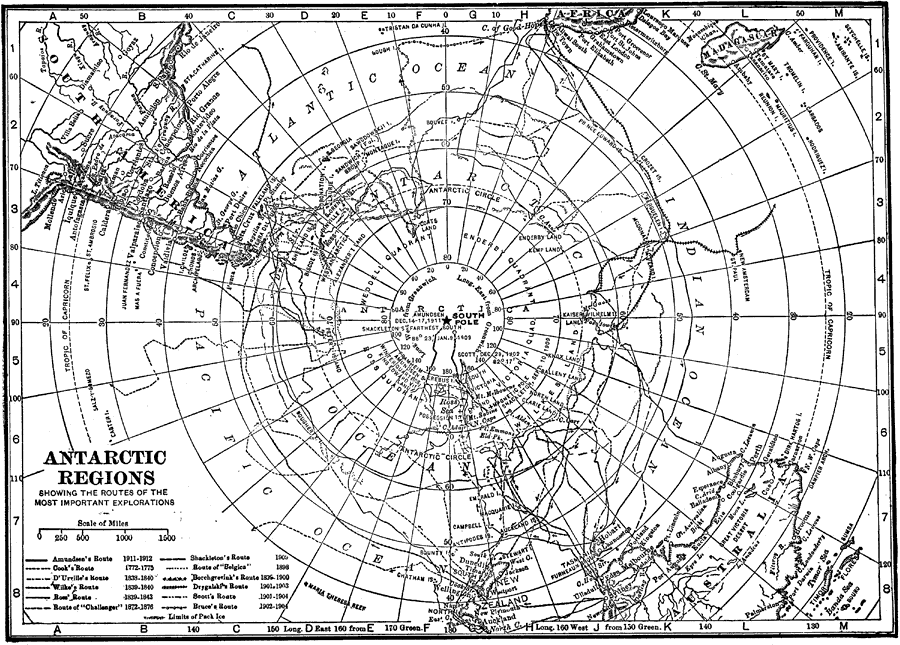
Description: A map of the South Polar Region from 1912 showing the routes of several Antarctic explorations. The map shows the route and date Amundsen first reached the South Pole, and routes of Cook (1772–1775), D'Urville (1838–1840), Wilke (1839–1840), Ross (1839–1843), Borchgrevink (1898–1900), Drygalaki (1901–1903), Scott (1901–1904), Bruce (1902–1904), and Shackleton (1909).
Place Names: Antarctic Region, Antarctica, �Antarctic Ocea
ISO Topic Categories: inlandWaters,
oceans
Keywords: Exploration of the Antarctic Regions, physical, �historical, physical features,
topographical, inlandWaters,
oceans, Unknown, 1912
Source: The Manitoba Free Press, The Free Press Almanac Encyclopedia and Atlas (New York, NY: C. S. Hammond & Co., 1912) 127
Map Credit: Courtesy the private collection of Roy Winkelman |
|