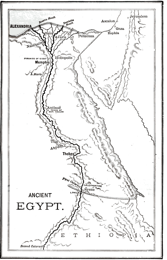
Description: A map of ancient Egypt showing the pyramids of Gizeh, the Tombs of Beni Hassan, and various ancient cities. The area known as Upper Egypt is the main focus of the map. Upper Egypt is the area from the First Cataract north to the delta. The First Cataract marks the end of the navigable part of the river from the Mediterranean Sea. "About seven hundred miles from the Mediterranean a low ledge of rocks, stretching across the Nile, forms the first obstruction to navigation in passing up the river. The rapids found at this point are termed the First Cataract." —Myers, 1896
Place Names: Egypt, Alexandria, �Memphis, �Thebes, �Antino&oum
ISO Topic Categories: boundaries,
inlandWaters
Keywords: Ancient Egypt, physical, �political, �historical, kAncientEgypt, physical features,
topographical, country borders, boundaries,
inlandWaters, Unknown, 3150 to 31 BCE
Source: P. V. N. Myers, A General History for Colleges and High Schools (Boston, MA: Ginn & Company, 1896) 18
Map Credit: Courtesy the private collection of Roy Winkelman |
|