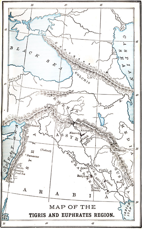
Description: A map of the Mesopotamia region during the Chaldean Dynasty. The map shows the lands of Assyria, Accad, Shumir (Sumer), Chaldæa, Elam or Susiana, and the outer territories of Syria, Armenia, Media, and Colchis near the Caucasus Mountains. The map shows the major rivers of the region, mountain systems, seas and lakes, important cities of the period, and the northern shoreline of the Persian Gulf at the time with a dashed line. "Basin of the Tigris and Euphrates. — The northern part of the Tigris and Euphrates valley, the portion that comprised ancient Assyria, consists of undulating plains, broken in places by considerable mountain ridges. But all the southern portion of the basin, the part known as Chaldæa, or Babylonia, having been formed by the gradual encroachment of deposits of the Tigris and Euphrates upon the waters of the Persian Gulf, is as level as the sea. [...] Within the Tigris–Euphrates basin, three great empires — the Chaldæan, the Assyrian, and the Babylonian — successfully rose to prominence and dominion. Each, in turn, not only extended its authority over the valley, but also made the power of its arms felt throughout the adjoining regions." — Myers, 1896, pp. 40-41.
Place Names: Southwest Asia, Arabia, �Syria, �Great Sea, �Assyria, �Black Sea, �Caspian Sea, �Armenia, �Tigris, �Euphrates, �Babyloni
ISO Topic Categories: inlandWaters,
oceans
Keywords: The Tigris and Euphrates Region, physical, �historical, physical features,
topographical, inlandWaters,
oceans, Unknown, 2700–539 BCE
Source: P. V. N. Myers, A General History for Colleges and High Schools (Boston, MA: Ginn & Company, 1896) 42
Map Credit: Courtesy the private collection of Roy Winkelman |
|