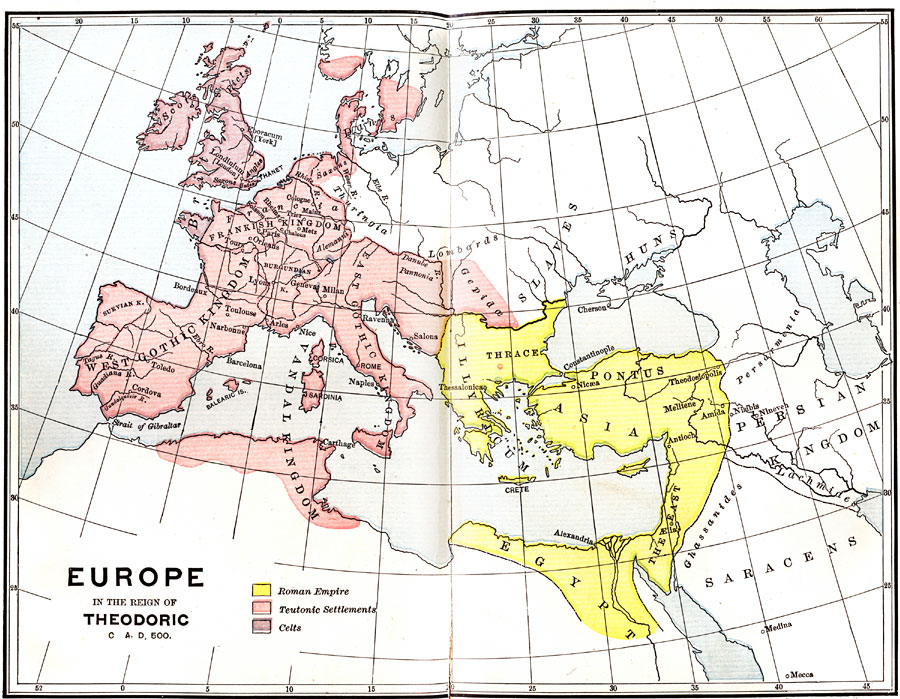
Description: A map of Europe during the Reign of Theodoric. Shows various kingdoms and the location of the Roman Empire, the Teutonic Settlements, and the Celts. Also shows the location of the Scots, the Britons, the Slaves, the Huns, the Danes, the Ghassanides, the Lachmides, and the Saracens.
Place Names: Regional Miscellaneous, Africa, �Asia, �Europe, �West Gothic Kingdom, �Frankish Kingdom, �Vandal Kingdom, �East Gothic Kingdom, �Illyricum, �Pontus, �Egypt, �Persian Kingdo
ISO Topic Categories: physical, �political, �historical, kWorldMedSea, kWorldAfroAsia, kWorldEurasia, kWorldEuroAfrica
Keywords: Europe in the Reign of Theodoric., physical, �political, �historical, physical features, country borders, physical, �political, �historical, kWorldMedSea, kWorldAfroAsia, kWorldEurasia, kWorldEuroAfrica, Unknown, Circa 500 BC
Source: P. V. N. Myers, A General History for Colleges and High Schools (Boston, MA: Ginn & Company, 1896) 370
Map Credit: Courtesy the private collection of Roy Winkelman |
|