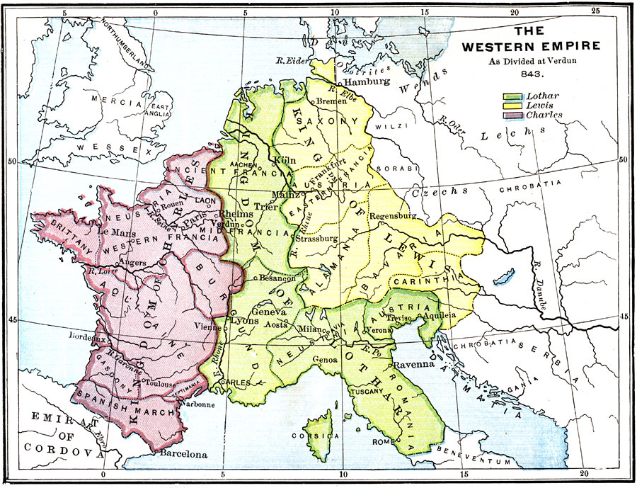
Description: A map of Europe showing the division of the Western Empire upon the death of Charlemagne. The Kingdoms of Lothar, Lewis, and Charles are shown on the map. "The mighty empire of Charlemagne fell to pieces soon after his death. ‘His scepter was the bow of Ulysses which could not be drawn by any weaker hand.’ After a troublous period of dissension and war, the empire was divided, by the important Treaty of Verdun, among Charlemagne's three grandchildren, — Charles, Lewis, and Lothar. To Charles was given France; to Lewis, Germany, and to Lothar, Italy and the valley of Rhone, together with a narrow strip of land extending from Switzerland to the mouth of the Rhine. With these possessions of Lothar went also the Imperial title." —Myers, 1896
Place Names: Western and Central Europe, Kingdom of Charles, �Kingdom of Lothar, �Kingdom of Lewis, �Emirat of Cordova, �Wessex, �Serbia, �Alamania, �Francia, �Bavaria, �Dalmati
ISO Topic Categories: boundaries,
oceans,
inlandWaters
Keywords: The Western Empire as Divided at Verdun, physical, �political, �historical, kCharlemagne, physical features, country borders, boundaries,
oceans,
inlandWaters, Unknown, A.D. 843
Source: P. V. N. Myers, A General History for Colleges and High Schools (Boston, MA: Ginn & Company, 1896) 408
Map Credit: Courtesy the private collection of Roy Winkelman |
|