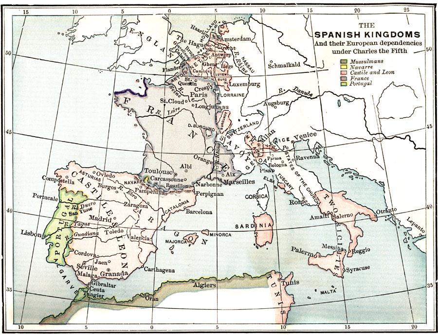
Description: A map of southwestern Europe and northwestern Africa showing the Spanish Kingdoms and their European dependencies during the reign of Charles the Fifth. Shows the locations of Mussulmans, Navarre, Castile and Leon, France, and Portugal.
Place Names: Regional Mediterranean, Africa, �Europe, �Mussulmans, �Navarre, �Castile and Leon, �France, �Portuga
ISO Topic Categories: physical, �political, �historical, kWorldMedSea, kWorldEuroAfrica
Keywords: The Spanish Kingdoms and their European dependencies under Charles the Fifth, physical, �political, �historical, physical features, country borders, physical, �political, �historical, kWorldMedSea, kWorldEuroAfrica, Unknown, 1556
Source: P. V. N. Myers, A General History for Colleges and High Schools (Boston, MA: Ginn & Company, 1896) 530
Map Credit: Courtesy the private collection of Roy Winkelman |
|