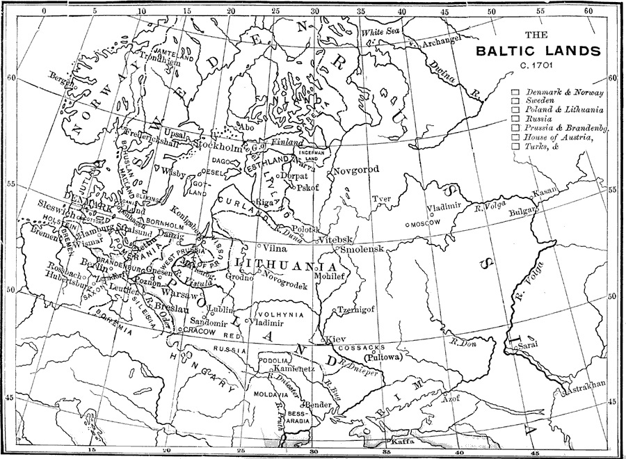
Description: A map of northeastern Europe during the time of Charles XII of Sweden. "Charles was but fifteen years of age when, in 1697, the death of his father called him to the Swedish throne. The dominions which came under his sway embraced not only Sweden, but Finland, and large possessions along the Southern Baltic, — territory that had been won by the arms of his ancestors. Taking advantage of Charles's extreme youth, three sovereigns, Frederick IV of Denmark, Augustus the Strong, Elector of Saxony and King of Poland, and Peter the Great of Russia, leagued against him (1700), for the purpose of appropriating such portions of his dominions as they severally desired to annex to their own." —Myers, 1896
Place Names: Western and Central Europe, Sweden, �Norway, �Russia, �Denmark, �Lithuania, �Poland, �Prussia, �Pomerania, �Hungar
ISO Topic Categories: boundaries,
oceans,
inlandWaters
Keywords: Northeastern Europe, physical, �political, �historical, physical features, country borders, boundaries,
oceans,
inlandWaters, Unknown, 1701
Source: P. V. N. Myers, A General History for Colleges and High Schools (Boston, MA: Ginn & Company, 1896) 636
Map Credit: Courtesy the private collection of Roy Winkelman |
|