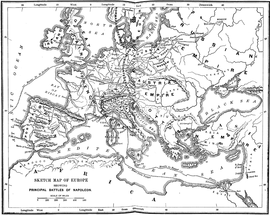
Description: A map of Europe (excluding Scandinavia) showing the principal campaigns and battles of Napoleon. The routes he traveled are indicated on the map. "From the coronation of Napoleon in 1804 until his final downfall in 1815, the tremendous struggle went on almost without intermission. It was the war of the giants. Europe was shaken from end to end by such armies as the world had not seen since the days of Xerxes. Napoleon, whose hands were upheld by a score of distinguished marshals, performed the miracles of genius. His brilliant achievements still dazzle, while they amaze, the world." —Myers, 1896
Place Names: Western and Central Europe, Africa, �Asia, �Europe, �Russian Empire, �Great Britain, �Ireland, �Spain, �Portugal, �Austrian Empire, �French Empire, �Ottoman Empire, �Italy,�Rhenish Confederation,
ISO Topic Categories: boundaries,
inlandWaters,
location,
society
Keywords: Sketch Map of Europe Showing Principal Battles of Napoleon, physical, �political, �historical, physical features, country borders, boundaries,
inlandWaters,
location,
society, Unknown, 1804–1815
Source: P. V. N. Myers, A General History for Colleges and High Schools (Boston, MA: Ginn & Company, 1896) 676
Map Credit: Courtesy the private collection of Roy Winkelman |
|