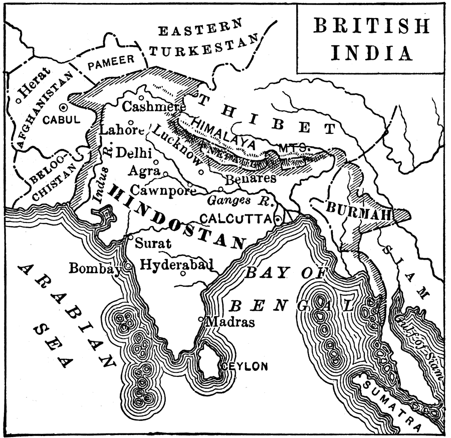
Description: A map from 1880 of Hindostan (India) after the Sepoy Mutiny (Indian Rebellion of 1857), when the government of India, by act of Parliament, was taken out of the hands of the East India Company and vested in the English crown. The map shows the British territories in 1880, including Burmah (Myanmar), the neighboring countries of Beloochistan, Afghanistan, Pameer, Nepal, and the frontiers of Eastern Turkestan, Thibet, and Siam. Major cities, rivers, and coastal features of the region are shown.
Place Names: India , Eastern Turkestan, �Afghanistan, �Hindostan, �Burmah, �Thibet, �Calcutta, �Bombay, �Arabian Sea, �Bay of Bengal, �Himalaya Mountains, �Indus Rive
ISO Topic Categories: boundaries,
inlandWaters,
oceans
Keywords: British India, physical, �political, �historical, physical features,
topographical, country borders, boundaries,
inlandWaters,
oceans, Unknown, 1880
Source: P. V. N. Myers, A General History for Colleges and High Schools (Boston, MA: Ginn & Company, 1896) 728
Map Credit: Courtesy the private collection of Roy Winkelman |
|