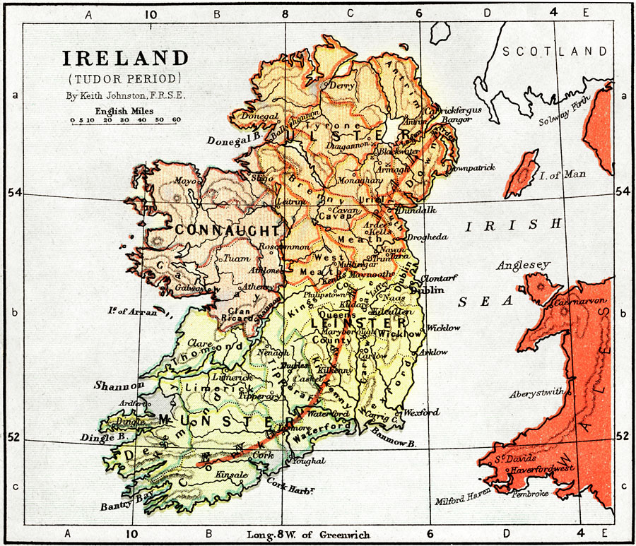
Description: Map of Ireland during the Tudor Period. Shows major cities of the time, major river ways, topography, political boundaries. Scale in English miles.
Place Names: Ireland, Limerick, �Cork, �Irish Sea, �Derry, �Ulster, �Leinster, �Munster, �Connaught, �Isles of Arran, �Clare, �Galway, �Donegal Bay. �Lagan River, �Meath, �Bremny, �Tara, �Uriel, �Waterford, �Cork Harbor, �Bantry Bay, �Dingle Bay, �Shannon River, �Shannon, �
ISO Topic Categories: boundaries,
elevation,
inlandWaters,
oceans,
transportation
Keywords: Ireland during the Tudor Period, physical, �political, �transportation, �historical, physical features,
topographical, country borders,
major political subdivisions, water routes, boundaries,
elevation,
inlandWaters,
oceans,
transportation, Unknown, 1485–1603
Source: Keith Johnston, The Half-Crown Atlas of British History (Edinburgh, Scotland: W. & A. K. Johnston, 1871) 6
Map Credit: Courtesy the private collection of Roy Winkelman |
|