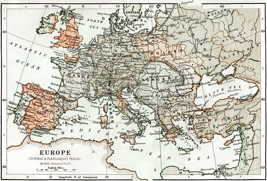
Description: Map of Europe during the Norman and Plantagenet Period. Shows major cities of the time, major river ways, topography, political boundaries. Scale in English miles.
Place Names: A Complete Map of Europe, France, �Poland, �Portugal, �Sweden, �Spain, �Ireland, �North Sea, �England, �Scotland, �Dublin, �London, �Atlantic Ocean, �Normandy, �Paris, �Castille, �Granada, �Aragon, �Roman Germanic Empire, �Denmark, �Baltic Sea, �Naples, �Sicily, �Osman Empire,
ISO Topic Categories: boundaries,
elevation,
inlandWaters,
oceans,
transportation
Keywords: Europe during the Norman and Plantagenet Period, physical, �political, �transportation, �historical, physical features,
topographical, major political subdivisions,
country borders, water routes, boundaries,
elevation,
inlandWaters,
oceans,
transportation, Unknown, 1066–1509
Source: Keith Johnston, The Half-Crown Atlas of British History (Edinburgh, Scotland: W. & A. K. Johnston, 1871) 8
Map Credit: Courtesy the private collection of Roy Winkelman |
|