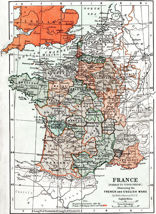
Description: Map of France and England during the Norman to Tudor Period. Illustrating the French and English Wars. Shows major cities of the time, major river ways, topography, political boundaries. Note: English Possessions after the Treaty of Bretigny (1360) colored red. Scale in English miles and French Leagues.
Place Names: France, Paris, �France, �United Kingdom, �London, �Normandy, �Pyrenees Mountains, �Loire River, �Royan , �Grenoble, �North Sea, �English Channe
ISO Topic Categories: boundaries,
elevation,
inlandWaters,
transportation
Keywords: France and England during the Norman to Tudor Period, physical, �political, �transportation, �historical, physical features,
topographical, country borders,
major political subdivisions, water routes, boundaries,
elevation,
inlandWaters,
transportation, Unknown, 1194–1337
Source: Keith Johnston, The Half-Crown Atlas of British History (Edinburgh, Scotland: W. & A. K. Johnston, 1871) 10
Map Credit: Courtesy the private collection of Roy Winkelman |
|