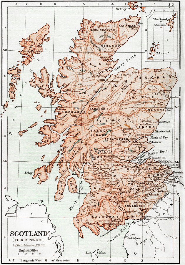
Description: Map of Scotland during the Tudor Period (1485 to 1558). This map shows major cities of the time, major river ways, topography, and political boundaries. Scale in English miles. There is an insert of the Shetland Isles and the Orkney Isles.
Place Names: United Kingdom, Edinborough, �Hebrides, �Firth of Forth,�Firth of Tay, �Firth of Clyde, �Solway Firth, �Annandale, �Clydesdale, �Moray Buchan, �Suherland, �Shetland Isles, �Orkney Isles, �Athole, �Cheviot Hills, �Lennox, �Moray Firt
ISO Topic Categories: boundaries,
elevation,
inlandWaters,
transportation
Keywords: Scotland during the Tudor Period, physical, �political, �transportation, �historical, physical features,
topographical, country borders, water routes, boundaries,
elevation,
inlandWaters,
transportation, Unknown, 1485–1558
Source: Keith Johnston, The Half-Crown Atlas of British History (Edinburgh, Scotland: W. & A. K. Johnston, 1871) 15
Map Credit: Courtesy the private collection of Roy Winkelman |
|