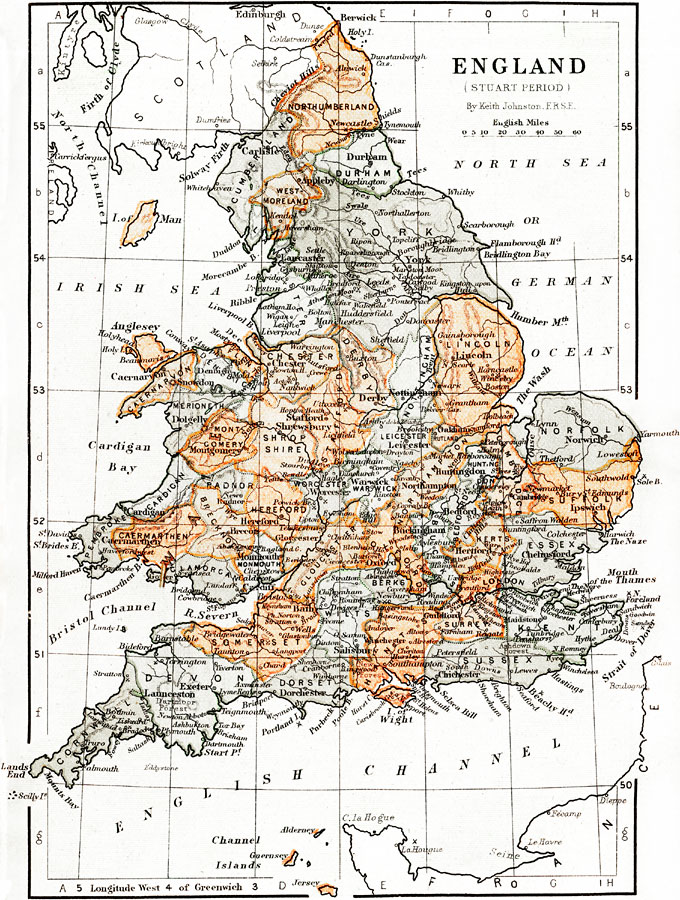
Description: This is a map of England and Wales during the Stuart Period, from the ascension of King James I in1603 to the death of Queen Anne in 1714. This map shows major cities of the time, major river ways, topography, and political boundaries. Several important battle sites from the English Civil Wars (1642–1651), which occurred during the Stuart dynasty, are shown.
Place Names: United Kingdom, London, �Liverpool, �English Channel, �Cardigan Bay, �Cornwall, �Landcaster,�Strait of Dover, �Isle of Wight, �Bath, �River Thames, �The Wash, �Lincoln, �River Trent, �Stafford, �Falmouth, �York, �German Ocean, �Lincoln, �Irish Sea, �North Channel, �Ch
ISO Topic Categories: boundaries,
elevation,
inlandWaters,
oceans,
transportation
Keywords: England during the Stuart Period, physical, �political, �transportation, �historical, physical features,
topographical, country borders,
major political subdivisions, water routes, boundaries,
elevation,
inlandWaters,
oceans,
transportation, Unknown, 1603–1714
Source: Keith Johnston, The Half-Crown Atlas of British History (Edinburgh, Scotland: W. & A. K. Johnston, 1871) 16
Map Credit: Courtesy the private collection of Roy Winkelman |
|