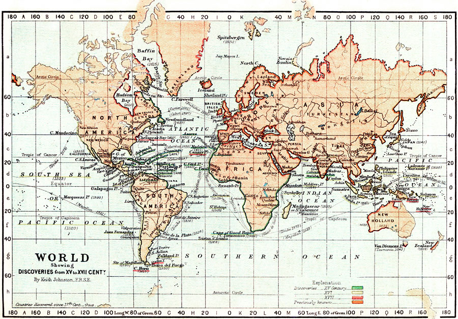
Description: This is a map of the World showing discoveries from 15th to 17th centuries. Shows continents, countries and major cities of the time, major river ways, topography, and voyages. Scale in English miles. The voyages of Magellan, Drake, Vasco de Gama, Columbus, Cabot, Cartier and Frobisher are all displayed. There is also a explanation of the color–coding of the discoveries by the century in which they were found.
Place Names: A Complete Map of Globes and Multi-continent, Africa, �Asia, �Australia, �Europe, �North America, �Pacific Ocean, �South America, �Greenland, �Atlantic Ocean, �Indian Ocean, �Southern Ocean, �South Sea, �Antartic Circle, �Artic Circle, �Iceland, �India, �Norway, �Japan, �Tibet, �New Holland, �New
ISO Topic Categories: boundaries,
inlandWaters,
oceans
Keywords: World Discoveries , transportation, �historical, �physical, physical features, water routes, boundaries,
inlandWaters,
oceans, Unknown, 1500–1700
Source: Keith Johnston, The Half-Crown Atlas of British History (Edinburgh, Scotland: W. & A. K. Johnston, 1871) 21
Map Credit: Courtesy the private collection of Roy Winkelman |
|