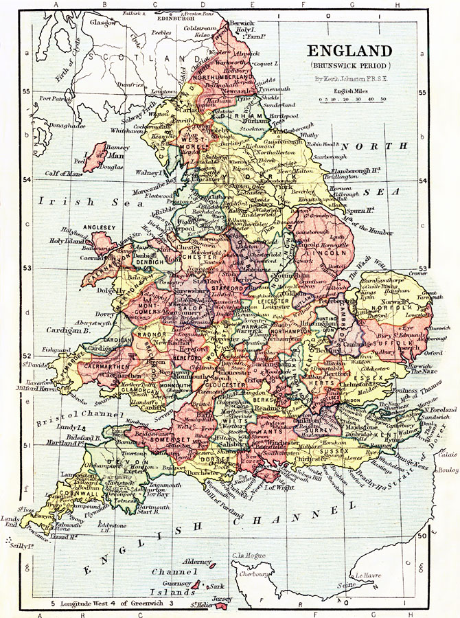
Description: This is a map of England and Wales at the beginning of the Brunswick Period (1714–1901). The Brunswick period began at the ascension of George I (House of Hanover) as King of Great Britain and Ireland, succeeding Queen Anne (House of Stuart), and ending at the death of Queen Victoria. The map shows major cities of the time, major river ways, topography and political boundaries. Scale in English miles.
Place Names: United Kingdom, London, �Plymout
ISO Topic Categories: boundaries,
elevation,
inlandWaters,
transportation
Keywords: England during the Brunswick Period, physical, �political, �transportation, �historical, physical features,
topographical, country borders,
major political subdivisions, water routes, boundaries,
elevation,
inlandWaters,
transportation, Unknown, 1714–1901
Source: Keith Johnston, The Half-Crown Atlas of British History (Edinburgh, Scotland: W. & A. K. Johnston, 1871) 22
Map Credit: Courtesy the private collection of Roy Winkelman |
|